Waterproof Charts 27 Stratford Shoal to Newport Rhode Island Navigation Chart Map
Sale
Regular price
$24.95
1 available
Stratford Shoal to Newport Rhode Island Navigation Chart Map
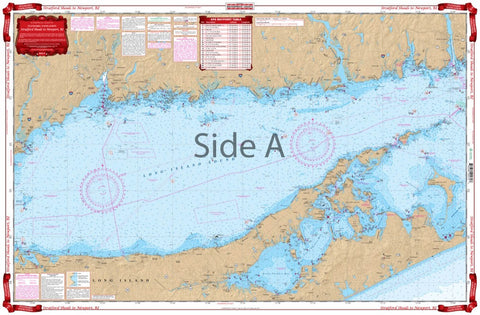
Overall coverage is from Port Jefferson, New York, east to New London on one side, and continuing east through Block Island Sound past Block Island and north to Newport Rhode Island.
A total of 29 GPS Waypoints are printed directly on the chart.
Includes Peconic and Gardiner Bays.
Large place names make areas easy to find.
You’ll love the feeling of pulling out this nautical map and knowing exactly where you are heading.